 What is the Fire & Watershed Recovery Project?
The Fire & Watershed Recovery Project is a joint effort by the Santa Barbara Botanic Garden and Conservation Biology Institute to understand how habitats are recovering in the Thomas and Whittier Fire Scars, as well as to effectively plan and prioritize restoration intervention actions using a decision-making support system. Our project is unique in that we are leveraging the power of over 200 volunteer community scientists to broaden our data collection efforts and to increase awareness about post-fire habitat recovery. With the help of our volunteers, we are collecting data on invasive species locations and sites of potential and actual erosion. We are currently in our second year of surveying with the help of our community scientists, and we have collected over 4,700 datapoints. This data is being fed into an Environmental Evaluation Modeling System (“EEMS model”) which will help us to understand which regions in the fire scar are most at risk of slowed or halted recovery, indicating where restoration actions would be most impactful.
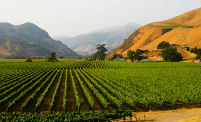
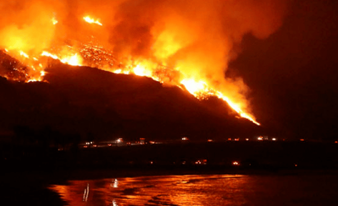
The 2017 Thomas and Whittier Fires in Santa Barbara and Ventura Counties left large, charred footprints in our local ecosystems. Fires are a natural part of the disturbance cycle in many California ecosystems and many plants are well adapted to respond and regrow after fire, but recovery is not guaranteed. Recovery to these two fires must contend with a combination of a protracted regional drought, severe debris flows following the fire, a changing climate, and our current position in the Earth’s sixth major extinction event. Thus, the natural recovery process may be slowed or halted, and we may see an increase in the spread of invasive plant species, some of which are more flammable than native plants. Bare, post-fire soils can also increase the risk of fatal debris flows, but this risk can be lessened by restoring sites with high erosion potential. Furthermore, land managers are often required to make difficult decisions about which areas and interventions to prioritize across large landscapes with limited resources and are rarely provided with support tools to help make these decisions. This project combines on-the-ground data collected by ecologists and volunteers with spatial datasets for geologic and landscape factors such as shake potential and habitat value to identify and prioritize areas that will benefit most from restoration interventions. By providing context for the costs and benefits associated with interventions in different areas, we will be able prioritize interventions to most effectively use the limited resources available to protect native habitats, prevent biodiversity loss, and reduce soil erosion and potential for debris flows.
The Blueprint is a central repository and portal for us to share our data with others, report our “work-in-progress” (WIP) findings, and fine-tune our maps and models with collaborators. The Blueprint has also been a valuable source of other data layers which inform our prioritization model. Our Guide and Case Study is currently available on the SBC Blueprint, where it displays the results of our first year of data collection, though since these data and models are WIP they are not yet final results and are subject to change.
The Blueprint has been an effective and helpful tool for gathering, storing, and sharing data across collaborators from different institutions and organizations.